Skip to content
Menu

These earn us a commission through Viator. Same price for you, and the commission had no hand in the order.

Search
Small cups of espresso on a counter at a pavement coffee window
Unsplash

Neighbourhood

Sunset Harbour

Last updated

Four blocks on the bay where the roads were lifted two feet above the shopfronts, and where South Beach residents actually eat.

Walk west across Alton Road at 18th Street and something looks wrong. The pavement is higher than the shops. Restaurants sit down a step or two from the street, and their first-floor windows are at your knee. It is not settlement or bad design. It is the most visible piece of climate adaptation in the United States, and you are standing on it.

Sunset Harbour occupies roughly four blocks between 17th and 20th Streets, west of Alton Road, between Purdy Avenue and Bay Road, backing onto Biscayne Bay. It used to be a boatyard and light-industrial district — hulls, welding, storage — and it held the lowest ground on the island, around 20th and Purdy. That low ground flooded on king tides in autumn, without a drop of rain falling, as bay water came up through the storm drains and stood in the street.

From February 2015 the City of Miami Beach rebuilt the neighbourhood's streets, raising them by around two feet, installing pumps and rebuilding the drainage. Most of Sunset Harbour was done within about eighteen months. It worked: the raised roads stay dry on the tides that used to close them. It also produced consequences nobody had modelled. Buildings that were not raised now sit below their own street. One local restaurateur's flood claim was initially refused when his insurer reclassified a ground-floor dining room as a basement, measured against the new road. Similar arguments and lawsuits followed elsewhere on the island.

That is the reason to come here and look. Everywhere else on earth, sea-level adaptation is a report. Here it is a kerb you can put your foot on.

The other reason is dinner. Once the boatyards went, the strip filled with the things residents want and tourists rarely find: a supermarket people actually shop in, coffee, gyms and studios, and a run of restaurants that are serious without being on anybody's Ocean Drive list. It is a working neighbourhood with four good blocks in it, which is exactly what South Beach otherwise lacks.

Getting there and parking

West of Alton Road between roughly 17th and 20th Streets, on the bay side of South Beach.

Walking. Ten to twelve minutes west from the middle of Lincoln Road, straight across Alton Road. Around twenty-five to thirty minutes from Ocean Drive, the full width of the island.

Parking. There is a municipal garage on 20th Street in the middle of the neighbourhood, which makes this one of the few parts of South Beach where parking is a solved problem. Use it rather than circling the metered streets, which are narrow, busy with residents and enforced constantly.

Trolley and bus. The free Miami Beach Trolley's South Beach loop serves Sunset Harbour and Alton Road, as does the South Beach Local bus. Alton Road also carries the causeway routes to the mainland.

From the mainland. The Venetian Causeway lands at Dade Boulevard a few minutes north-east and is the closest crossing; it is tolled, narrow and pleasant. The MacArthur Causeway lands at 5th Street, from where Alton Road runs north for fifteen blocks.

How to read the raised streets

Walk the strip slowly and the engineering becomes legible.

Look at the doorways. Where a building was constructed before the works and not raised, its entrance now sits below the new pavement, reached by a step down or a short ramp. Some owners rebuilt their frontages to meet the new level and some did not, so you can read the sequence of decisions along a single block.

Look at the kerbs and driveways. Crossings and vehicle entrances are ramped to bridge the two-foot difference, and the transitions are steepest where a building refused to move.

Look for the pump stations. Raising a road only works with drainage that can lift water back out against a high tide, so the programme installed pumps. They are boxy, unglamorous structures at the edges of the neighbourhood, and they are the half of the project that actually does the work.

Understand what the tide does. The flooding this was built for is not storm flooding. It is king tides — the highest tides of the year, clustering around the autumn — pushing bay water up through the drains into the street on clear, sunny days. The local phrase for it is sunny-day flooding.

The argument that followed. Raising public streets while leaving private buildings at the old level shifted water and risk onto those buildings, and property owners elsewhere on Miami Beach sued over it. The city's position is that streets are the part it controls and the part that must stay passable. Both things are true.

The strip, and why residents use it

This page does not name restaurants, because a four-block commercial strip turns over faster than any guide updates. What it can tell you is the shape of the place.

What is here. A supermarket that residents genuinely shop in rather than a tourist convenience store. Independent coffee. A concentration of fitness studios out of proportion to the population — spin, pilates, boxing — which tells you a good deal about who lives here. A run of restaurants covering sushi, Italian, seafood and casual American, most of them small, most of them booked at weekends. A few boutiques.

Why it works. No hosts on the pavement with laminated cards. No automatic service charge culture in the way Ocean Drive has it. Prices are South Beach prices — this is not a cheap neighbourhood — but you are paying for the food rather than for the address.

When. Weekday evenings are calm. Friday and Saturday are busy and worth booking. Lunchtime is quiet and mostly local. Sunday mornings are the neighbourhood at its most itself.

Combine it. Maurice Gibb Memorial Park is a five-minute walk north-west, on the bay, with the best sunset view in South Beach. Eat early, walk to the park for sunset, come back for a drink. That sequence is the reason to plan an evening here rather than passing through.

Getting a table. Reserve for anything at a weekend. This is a small strip serving a residential neighbourhood, not a district with capacity to absorb a crowd.
What it was, and what it became

Sunset Harbour was built as the island's back of house. The bay frontage here was working water: boatyards, marine repair, storage and light industry, serving the yachts moored a few hundred metres away and the city behind them. That is why the streets are wide, the buildings are low and rectangular, and the grid does not match the deco blocks across Alton Road.

The shift came in stages from the 1990s onwards, as marine industry left, warehouses turned into studios and restaurants, and residential towers went up along the bay. A yacht club marina still operates on the water, so the neighbourhood has not entirely stopped being what it was.

What makes it architecturally interesting is precisely that it is not deco. The Art Deco Historic District ends at Lenox Court, and Sunset Harbour sits outside it in every sense: 1950s and 1960s industrial stock, some of it converted with care and some of it replaced. For anyone who has spent two days looking at eyebrows and stepped parapets, the change of register is a relief.

The bay edge is the other thing. From the western ends of the streets you get water, boats and the causeway, and the neighbourhood's own marina basin. Public access to that edge is partial — much of it is private — which is the standard Miami Beach compromise and the reason Maurice Gibb Memorial Park matters so much to this side of the island.

Getting here and parking, which is genuinely easy for once

Walking. Ten to twelve minutes west from the middle of Lincoln Road, crossing Alton Road. Around twenty-five to thirty minutes from Ocean Drive, which is the full width of the island.

Parking, and this is the unusual part. There is a municipal garage on 20th Street in the middle of the neighbourhood. In South Beach, where parking is the hardest practical problem on the island, having an obvious garage in the middle of where you are going is close to a luxury. Use it. The metered streets around it are narrow, heavily used by residents and enforced constantly, and the time saved is not worth the few dollars.

Trolley and bus. The free Miami Beach Trolley's South Beach loop covers Sunset Harbour and Alton Road; the South Beach Local bus also serves it. From the mainland, Alton Road carries the causeway bus routes.

Driving in from the mainland. The Venetian Causeway lands at Dade Boulevard a few minutes north-east and is the closest crossing. The MacArthur Causeway lands at 5th Street, then Alton Road north for fifteen blocks.

What is within five minutes on foot. Maurice Gibb Memorial Park on the bay. The western end of Lincoln Road. The Miami Beach Botanical Garden and the convention centre district, about ten minutes east. The Venetian Causeway, for cyclists, heading west to the mainland across the islands.

Tours that visit Sunset Harbour

Operators run these trips past Sunset Harbour, or stop there as part of a longer route. We list what the booking data supports — not everything that mentions the name.

These earn us a commission through Viator. Same price for you, and the commission had no hand in the order.

Private and small-group departurespriced per boat or per vehicle, not per person

Near Sunset Harbour

Straight-line distances, so allow more on the road — the island is long and has one main parkway.

  • A public fishing pier running out over the water with a city skyline behind it at dusk

    Park

    Maurice Gibb Memorial Park

    Free

    The bayfront park where South Beach actually watches the sun go down, with a Bee Gees playground and a mangrove shoreline.

    0.5–1.5 hoursFree. The playground, dog park, fishing pier and overlooks all cost nothing.450 ft away

  • A wide pedestrian shopping street lined with palms and terraces under strong midday sun

    Shopping

    Lincoln Road Mall

    Free

    A Morris Lapidus landscape from 1960 that has become a chain high street, with three blocks at the western end that have not.

    1–3 hoursFree to walk. Shops, restaurants, cinema and theatre tickets are not.0.4 mi away

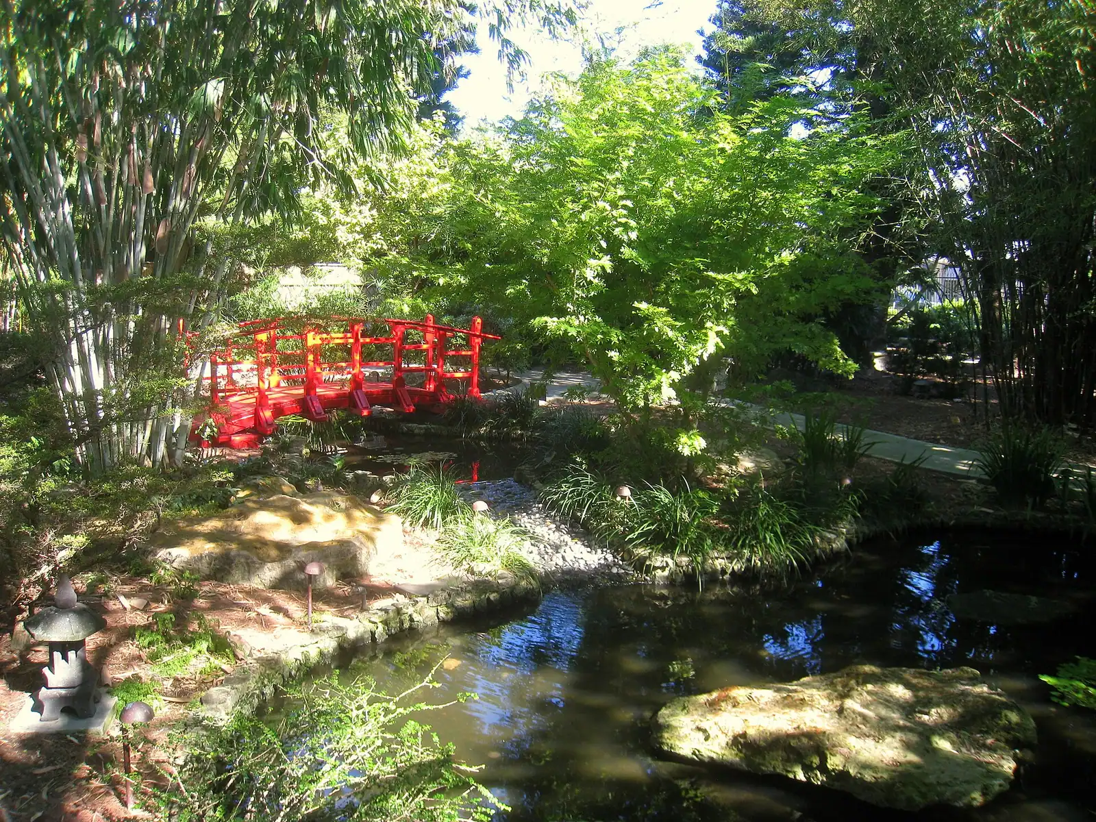
  • A red timber bridge crossing the pond in the Japanese garden at the Miami Beach Botanical Garden

    Park

    Miami Beach Botanical Garden

    Free

    Two and a half acres of free, densely planted shade behind the convention centre — the coolest ground in South Beach in August.

    0.5–1 hoursFree. Donations and memberships support the non-profit that runs it.0.6 mi away

  • A player resting courtside on a blue hard tennis court with racket and balls

    Park

    Flamingo Park

    Free

    The island's largest park, four blocks inland, where spring-training baseball was played in the 1930s and residents still run the place.

    0.5–3 hoursThe park, paths, playground, dog park, track and open courts are free. Tennis and the aquatic centre are ticketed, with non-resident rates recently in the high teens per person per hour or per session and lower rates for Miami Beach residents.0.7 mi away

Sunset Harbour: common questions

Why are the streets higher than the shops in Sunset Harbour?

Because the city raised them. Sunset Harbour held the lowest ground on Miami Beach, around 20th Street and Purdy Avenue, and flooded on king tides with no rain falling as bay water came up through the storm drains. From February 2015 the City of Miami Beach raised the streets by around two feet and installed pumps. Buildings that were not raised now sit below their own road, which is why you step down into some shopfronts.

Is Sunset Harbour worth visiting in South Beach?

For dinner and for the engineering, yes. It is four blocks on the bay where residents actually eat — a real supermarket, independent coffee, a run of small serious restaurants — without the pavement touting and automatic service charge culture of Ocean Drive. It is also the clearest place in the United States to stand on a piece of completed sea-level adaptation. It is not an attraction with anything to see beyond that.

Did raising the roads in Miami Beach cause problems?

Yes, and the city does not pretend otherwise. Lifting public streets while private buildings stayed at the old level shifted water and risk onto those buildings. One Sunset Harbour restaurateur had a flood claim initially refused after an insurer reclassified his ground-floor dining room as a basement relative to the new road, and property owners elsewhere on the island took the city to court. The raised roads themselves have stayed dry on the tides that used to close them.

Where do locals eat in South Beach?

Sunset Harbour is the honest answer, along with parts of South of Fifth and the streets west of Washington Avenue. The Sunset Harbour strip runs roughly four blocks between 17th and 20th west of Alton Road, and its restaurants are small, mostly booked at weekends and priced for the neighbourhood rather than for the view. No restaurant is named on this page because a strip this size turns over faster than any guide can keep up with.

Is parking easy in Sunset Harbour?

Unusually for South Beach, yes. There is a municipal garage on 20th Street in the middle of the neighbourhood, which means you can park once and walk to everything. The metered streets around it are narrow, heavily used by residents and enforced constantly, so the garage is worth the few dollars. It is one of very few parts of the island where driving is not actively the wrong decision.